Newly updated, high-resolution satellite datasets integrated into Google Earth have exposed a comprehensive and irreversible restructuring of the geographical and urban architecture of the southern Gaza Strip. Captured officially on February 25, 2026, these advanced aerial maps offer international defense analysts and human rights organizations an unyielding, empirical record of systematic landscape erasure.
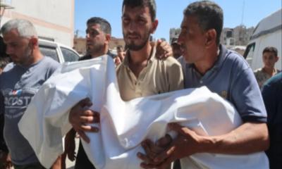
Entire municipal grids, multi-generational agrarian zones, historical villages, and recognized protective sanctuaries have been wiped from the map. For the displaced Palestinian populace, this cartographic update serves as an absolute diagnostic indicator of a continuous military offensive that has claimed the lives of nearly 73,000 individuals, demonstrating that neither civilian infrastructure above ground nor the resting sites of the deceased below have been spared from total mobilization.
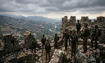
The human dimension of this geographical erasure is articulated by Palestinian journalist Muhannad Qishta, whose family narrative has been completely excised from the physical territory. The historical Sheikh Mohammed cemetery, located within the Maan sector of Khan Younis, has completely vanished from current surveillance maps. Where Qishta’s sisters, Reem and Walaa, were previously interred alongside generations of local families, the updated imaging reveals a heavily consolidated, flattened landscape occupied by Israeli armor, heavy transport assets, and fortified tactical command outposts.
This specific structural transformation aligns with recent investigative metrics published by the Euro-Med Human Rights Monitor, which confirm that occupying forces have fully or partially demolished ninety-four percent of Gaza`s active cemeteries, effectively converting spaces of communal memory into fortified military installations.
The Erasing of Geography and Communal Memory
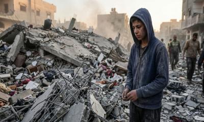
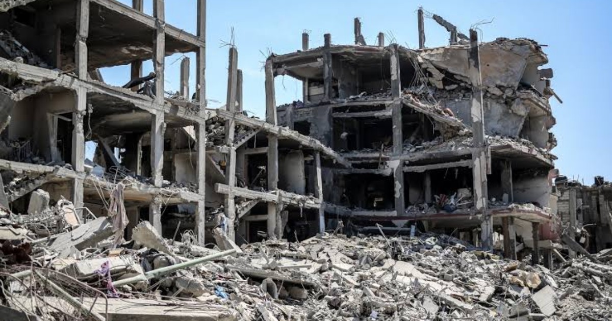
The expansive cartographic data accessible on Google Earth establishes that core residential zones have been rendered entirely indistinguishable, thoroughly scrambling the baseline coordinates of the coastal enclave. This calculated method of destruction reaches peak intensity inside the southern governorate of Rafah. In the western sector of Tal as-Sultan, the prominent Saudi Neighborhood—a planned residential initiative comprising 752 modern housing units—has been completely reduced to uniform mounds of pulverized concrete.
Although the United States administration initially established a public "red line" regarding a full-scale ground operation into Rafah in early 2024, the offensive proceeded without incurring any tangible international diplomatic or economic penalties, culminating in the near-total leveling of the city`s urban perimeter.
Further west along the Mediterranean shoreline, the historical Swedish Village has been systematically scrubbed from the physical geography, transitioning from a dense coastal community into an exclusive military security zone. Established originally in 1965 with Scandinavian humanitarian assistance to house displaced Palestinian refugees, the village supported a vibrant local economy built entirely around artisanal maritime fishing.
Decades of sustainable maritime commerce, local boat maintenance facilities, and a dedicated civic community center have been thoroughly cleared by heavy engineering units, leaving a mere five residential structures standing amidst a sea of military grading. A parallel transformation is visible at the Rafah Border Crossing, which historically functioned as the primary, independent logistical life support pipeline for the local population. The crossing’s expansive civilian departure terminals, VIP reception bays, and specialized humanitarian cargo screening yards have been entirely replaced by reinforced observation towers and deep networks of concertina wire.
Systemic Collapse of Education and Agriculture
In the eastern agrarian sectors of Khan Younis, including Bani Suhaila, Abasan, and al-Zana, Israeli armored formations have embedded themselves permanently within former civilian sectors to construct a secure perimeter. Prior to the escalation, these eastern districts operated as the primary agricultural and residential breadbasket of the southern governorate, housing over 120,000 citizens within tightly integrated, multi-generational housing blocks.
The methodical demolition of entire residential blocks was executed to carve out unmonitored military supply corridors, forcing the mass displacement of the local population into the overcrowded, arid tent settlements of al-Mawasi or the remaining public facilities in Deir el-Balah. Similarly, Hamad City—a 135-million-dollar flagship public housing project consisting of fifty-three modern, five-story residential structures—has been converted into an empty, hollowed-out shell, displacing over 15,000 low-income families whose homes were reduced to extensive fields of rubble.
The structural targeting of civilian society is further evidenced by the systematic dismantling of the territory’s academic foundations. Official reporting from UNICEF indicates that over ninety-seven percent of all primary and secondary educational facilities have sustained catastrophic structural damage, effectively depriving 658,000 children of access to formal learning systems for more than two consecutive years.
The higher education sector has been entirely dismantled through controlled military demolitions, as demonstrated by the complete destruction of the Islamic University of Gaza, which previously accommodated over 20,000 active students, and Al-Azhar University, which registered more than 16,000 scholars. The leveling of these landmark campuses, alongside Al-Israa University further south, completely eliminates the academic and professional prospects of Gaza`s youth.
Concurrently, the total destruction of localized greenhousing systems and cultivated fields across Rafah and Khan Younis has engineered a severe, artificial food crisis. These fertile quadrants previously generated over forty percent of the enclave`s daily fresh vegetable, olive, and citrus demands. The United Nations Food and Agriculture Organization recently issued a grim warning confirming that less than five percent of Gaza’s total agricultural land remains structurally cultivable.
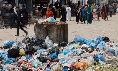
In the Shakoush area, heavy military bulldozers systematically stripped away vital topsoil layers and demolished complex greenhouse networks, directly accelerating a severe, state-engineered famine. Local journalists report that thousands of families return daily from makeshift soup kitchens with empty containers, standing as a stark baseline indicator of the absolute failure of contemporary international humanitarian law to protect basic human survival.